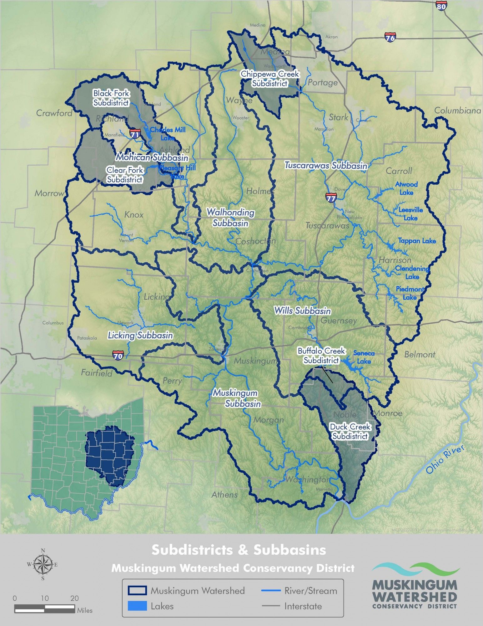
The MWCD was created in 1933 and is the largest conservancy district in Ohio, serving more than 2 million residents in an 18-county jurisdictional area. It manages 57,000 acres for public use, comprised of 16,000 acres of water surface at 10 lakes and 41,000 acres of land.
The Walhonding and Tuscarawas rivers meet in Coshocton in Coshocton County to form the Muskingum River, which flows south to the Ohio River at Marietta in Washington County. The Muskingum River Watershed is the largest watershed in Ohio, covering one-fifth of the State of Ohio and provides flood reduction and water conservation benefits through a system of dams and reservoirs. Through a partnership with the U.S. Army Corps of Engineers (USACE), which owns and operates the dams in the region, the system of reservoirs and dams has prevented more than $8 billion in potential property damage and saved countless lives. The system is divided into three subwatershed regions: the Walhonding River Watershed in the northwest area, the Tuscarawas River Watershed in the northeast area, and the Lower Muskingum River region in the southern area.
The Walhonding Region
The Walhonding Region is comprised of Ashland, Richland, Knox and portions of Wayne, Holmes and Coshocton counties. The reservoir system in this region includes Charles Mill, Mohicanville, Mohawk, North Branch Kokosing, and Pleasant Hill.
The Tuscarawas Region
The Tuscarawas Region is comprised of Carroll, Stark, Tuscarawas, Harrison and portions of Summit, Wayne, Holmes, Belmont, and Coshocton counties. The reservoir system in this region includes Atwood, Beach City, Bolivar, Clendening, Dover, Leesville, Piedmont, and Tappan.
The Lower Muskingum Region
The Lower Muskingum Region covers Licking, Muskingum, Guernsey, Morgan, and portions of Coshocton, Noble, and Washington counties. The reservoir system in this region includes Dillon, Senecaville, and Wills Creek.

